Geo-Trips :: Scottish Hill Track 329, Strathrory to Dalnaclach circular walk
Near Tain, Easter Ross
A walk from Aldie Burn Forestry Commission car park, Sat, 30 Jun 2018 by Julian Paren
Each year a walks programme is organised for members of Scotways - the Scottish Rights of Way and Access Society. Besides being a social activity and led by a local member, the opportunity is taken to check up on the signage and the state of a Hill Track and exploring whether any maintenance is required. Scottish Hill Track 320 is a 7 km linear link from Strathrory to Dalnaclach. The opportunity was taken to create a circular walk starting from the Forestry Commissions Aldie Burn car park and traversing the Morangie Forest from east to west before heading down into Strath Rory. This forest section was mainly on wide fit-for-purpose forestry roads (which are also used in the winter Snowman Car Rally), but with local knowledge a detour was made to pass old inhabited sites now buried within the forest.
The leaders of the walk had a vast knowledge of all the archaeology that could be seen if the vegetation and woodland had not been so dense, and others on the walk were experts in the flora and fauna. Pine marten scats, flowers in the Aven family, chickweed wintergreen, fox and cubs all provided a reason to slow the pace and discuss the finds.
The drove road in Strath Rory was a delight and apparently used by D of E expeditioners for their hiking qualifications. The walk whetted the appetite for a return in the autumn to visit the fort at Cnoc an Duin below which the Strath Rory path passes. The contrast between a managed forest and a path through a once-frequented glen was striking. I would have preferred to have been a drover than a forester!
The walk ended at Dalnaclach and a car took the walkers the few miles back to the Aldie Burn car park.
Walk length 19.3 km Time taken 6 hour with stops for archaeology and assessing flowers.
Scottish Hill Tracks describes the final 7 km of the route as follows:
Scottish Hill Track 320 Strathrory to Dalnaclach
7 km/4 miles OS Sheet 21 Start NH 667778 Finish NH 733763
This route was part of a network of old drove roads leading from Caithness and Sutheriand to Milton and Kildary. The start is signposted to Dalnaclach on the B 9176, on a bend just north-east of the Strathrory Bridge. There is parking space for a dozen cars. Take the track SE, down to the Strathrory River, and then the right fork through a gate. Shortly after this the stony track changes to a grassy, and sometimes boggy, indistinct path alongside the river. Many of the boggy places and burns have boardwalks or bridges. Pass south of Cnoc an Duin to a derelict cottage at Coag. Just before Scotsburn House take a left fork which Ieads between the edge of farmland and mixed woodland to a car park (6-8 cars) at the white croft house of Dalnaclach.
On the map below, the grey line is the GPS track from this trip. Click the blue circles to see a photograph taken from that spot and read further information about the location. The blue lines indicate the direction of view. There is also a slideshow of this trip. ( )
↓ Scroll down here ↓
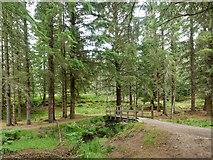
Bridge over Aldie Water
The bridge is close to the Forestry Commission's car park for accessing the Aldie... more
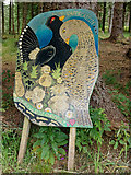
Promoting Capercaillies, Morangie Forest
A beautifully executed artwork to remind walkers in the forest to do their utmost... more
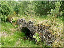
Small old bridge above a burn in Morangie Forest
Most would pass by on the track unaware of what lay below.
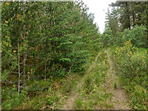
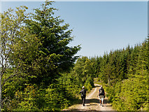
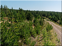
Minor track in Morangie Forest
Easier on the feet that the prepared Forestry Roads capable of taking 20 ton... more

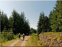
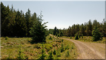
Track in Morangie Forest
Worth exploring on another day!
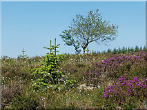
Open area in Morangie Forest
The forest road is mainly in dense forestry. Here was an exception.
Walking the Forest Road west towards the B 9176
A sunny day in Morangie Forest.
Walking on a Forest Road in the Morangie Forest
Too hot a day for an extended walk.
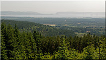
Misty view to the entrance of the Cromarty Firth
Looking over the trees and into the mist oil rigs can be seen. The North Sutor... more
Forestry Road in Morangie Forest
The Snowman Rally comes through here, but at a very different season of the year!
Walking the Morangie Forest road towards Cnoc an t-Sabhail
Ever upwards in the heat of the day. The road is used in the Snowman Rally and by... more

Morangie Forest road above Strath Rory
The road climbs evenly up to its highest point.
Forest Road in Morangie Forest
Here were younger trees beside the road.
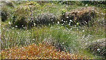
Hilltop vegetation, Morangie Forest
Cotton grass, moss and an occasional foxglove.
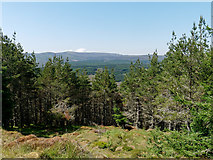
Outlook from ridge of Cnoc an t-Sabhail
A glimpse west from between the trees.
Descending to Strathrory
The road twists in its descent to create an even gradient for heavy forestry traffic.
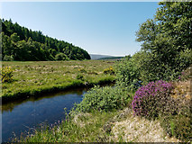
Outflow from Loch Sheilah
Walking through Strath Rory
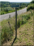
A post linked to the path's status as Hill Track 320 of Scotways (Scottish Rights... more
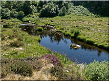
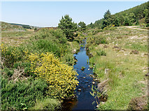
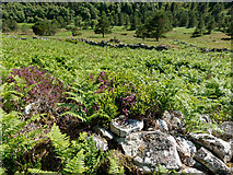
Balnagown River in Strath Rory
A limpid stream after a period of drought.
Balnagown River in Strath Rory
Little water flow after a pronged dry period of weather.
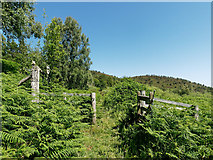
Gate on the Strath Rory path
Here the contemporary path (supported by slatted boards over boggy areas) rejoins... more
Hill Track 320 through Strath Rory
The track is listed in the Scotways handbook - Scottish Hill Tracks - as No 320.... more
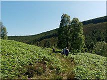
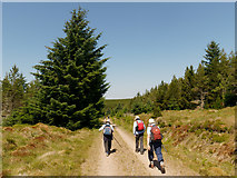
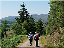
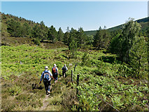
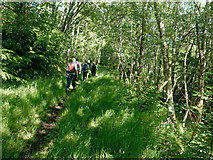
Path through Strath Rory
The walkers are members of Scotways checking on Scotway's Hill Track 320.
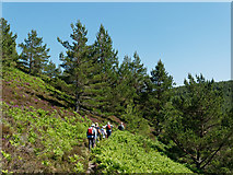
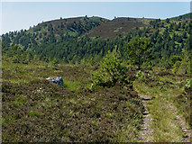
Path in Strath Rory below Cnoc an Duin
The hilltop fort is not visible from this angle.
Traces of a settlement, Strath Rory
Visible on the map, but covered over in high summer, a number of buildings exist... more
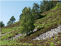
Hillside below Cnoc an Duin Hillfort
The hill is topped by a fort, apparently made of a similar rock to that seen on... more
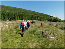
Path to Coag in Strath Rory
The hillfort is located at the cleft in the skyline atop Cnoc an Duin.
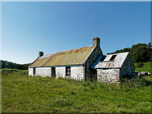
Coag - a primitive croft house
The building is open for all who might care to stay here. There are some holes in... more
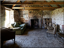
Inside Coag bothy
A bothy not listed by The Mountain Bothies Association and so not yet photographed... more
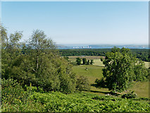
Land around Scotsburn
A view from the Strath Rory track that extends over the fields of Scotsburn to... more

Back gate to Scotsburn House
I suppose this used to be called The Tradesman's Entrance.
Strath Rory path beside the fields of Scotsburn House
The path shares the boundary between forest and agricultural land.
Scotways sign for Hill Track 320 Dalnaclach to Strathrory
The Scottish Hill Tracks publication gives a good description to the track along... more
All images © Julian Paren and available under a
Creative Commons licence  .
.