J3474 : Queen's Quay (part), Belfast
taken 15 years ago, near to Belfast, Co Antrim, Northern Ireland
This is 1 of 4 images, with title starting with Queen's Quay in this square
Queen's Quay (part), Belfast
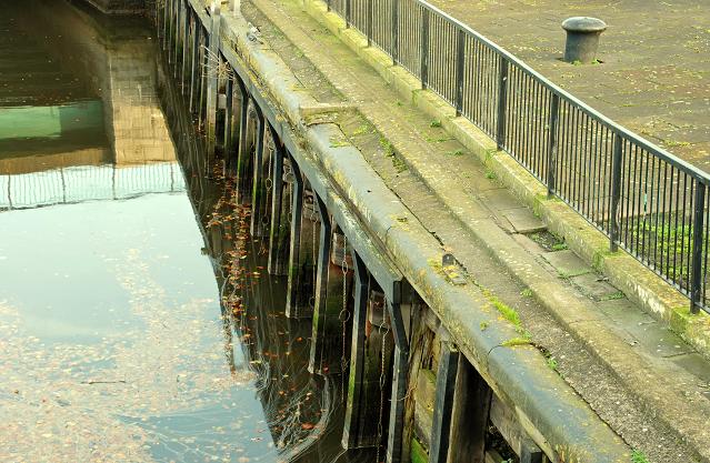
Before the building of the Queen Elizabeth Bridge J3474 : The Queen Elizabeth Bridge, Belfast, Queens Quay J3474 : Queen's Quay, Belfast (1987) extended south to the Queens Bridge J3474 : Queen's Bridge Belfast. This short section remains (disused) after more than 40 years. There is no official public access it is protected by a locked gate. See also J3474 : Old steps, Donegall Quay, Belfast.
![Creative Commons Licence [Some Rights Reserved]](https://s1.geograph.org.uk/img/somerights20.gif)
|
· Find out How to reuse this image ·
Share:
|
|||||
|
There are 4 posts in a
discussion on J3474 (preview on the left) |
Suggest an update to this image | Contact the contributor | |||
Loading map... (JavaScript required)
- Grid Square
- J3474, 4349 images (more nearby
 )
)
- Photographer
- Albert Bridge (find more nearby)
- Date Taken
- Sunday, 16 November, 2008 (more nearby)
- Submitted
- Sunday, 16 November, 2008
- Category
- Quay (more nearby)
- Subject Location
-
Irish:
 J 345 744 [100m precision]
WGS84: 54:36.0061N 5:55.1552W - Camera Location
-
Irish: J 345 744
- View Direction
- North-northeast (about 22 degrees)
Image classification(about):
Supplemental image
This page has been viewed about 95 times.
View this location:
KML (Google Earth) ·
Google Maps ·
Bing Maps ·
Geograph Coverage Map ·
More Links for this image
·
Bing Maps ·
Geograph Coverage Map ·
More Links for this image