G9379 : Old Eske road
taken 15 years ago, near to Donegal, Co Donegal, Ireland
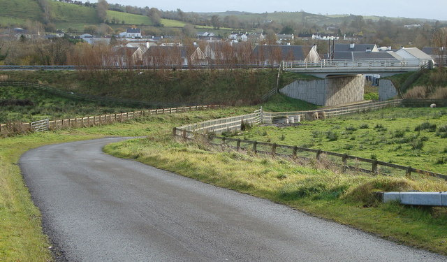
Old Eske road
This would have been the original route to Lough Eske, seen here under passing the N56, with Mill Race Crescent council estate beyond.
![Creative Commons Licence [Some Rights Reserved]](https://s1.geograph.org.uk/img/somerights20.gif)
|
· Find out How to reuse this image ·
Share:
|
|||||
| Start a discussion on G9379 | Suggest an update to this image | Contact the contributor | |||
Loading map... (JavaScript required)
- Grid Square
- G9379, 18 images (more nearby
 )
)
- Photographer
- louise price (find more nearby)
- Date Taken
- Sunday, 9 November, 2008 (more nearby)
- Submitted
- Thursday, 18 December, 2008
- Category
- Road bridge (more nearby)
- Subject Location
-
Irish:
 G 933 793 [100m precision]
WGS84: 54:39.7070N 8:6.2371W - Camera Location
-
Irish: G 935 794
- View Direction
- Southwest (about 225 degrees)
Image classification(about):
Geograph
This page has been viewed about 60 times.
View this location:
KML (Google Earth) ·
Google Maps ·
Bing Maps ·
Geograph Coverage Map ·
More Links for this image
·
Bing Maps ·
Geograph Coverage Map ·
More Links for this image