G5488 : Port harbour area
taken 19 years ago, 4 km N of Kilgoly, Co Donegal, Ireland
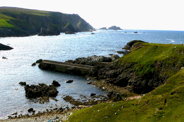
Port harbour area
I wondered how long this village existed and why it was deserted. I haven't found much information about it on the internet. I would think some locals would know the history of Port.
![Creative Commons Licence [Some Rights Reserved]](https://s1.geograph.org.uk/img/somerights20.gif)
|
· Find out How to reuse this image ·
Share:
|
|||||
| Start a discussion on G5488 | Suggest an update to this image | Contact the contributor | |||
Loading map... (JavaScript required)
- Grid Square
- G5488, 9 images (more nearby
 )
)
- Photographer
- Joseph Mischyshyn (find more nearby)
- Date Taken
- Sunday, 11 September, 2005 (more nearby)
- Submitted
- Tuesday, 10 February, 2009
- Category
- Harbour (more nearby)
- Subject Location
-
Irish:
 G 548 888 [100m precision]
WGS84: 54:44.7515N 8:42.0731W - Camera Location
-
Irish: G 548 888
- View Direction
- WEST (about 270 degrees)
Image classification(about):
Geograph (Third Visitor for G5488)
This page has been viewed about 44 times.
View this location:
KML (Google Earth) ·
Google Maps ·
Bing Maps ·
Geograph Coverage Map ·
More Links for this image
·
Bing Maps ·
Geograph Coverage Map ·
More Links for this image