G6790 : Mountainside at Maghera
taken 19 years ago, near to Crannogeboy, Co Donegal, Ireland
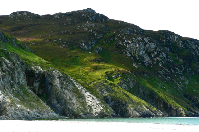
Mountainside at Maghera
The mountain slopes downward to Loughros Beg Bay and the beach at Maghera. Caves in the mountainside are said to be accessible only at low tide.
![Creative Commons Licence [Some Rights Reserved]](https://s1.geograph.org.uk/img/somerights20.gif)
|
· Find out How to reuse this image ·
Share:
|
|||||
| Start a discussion on G6790 | Suggest an update to this image | Contact the contributor | |||
Loading map... (JavaScript required)
- Grid Square
- G6790, 21 images (more nearby
 )
)
- Photographer
- Joseph Mischyshyn (find more nearby)
- Date Taken
- Sunday, 11 September, 2005 (more nearby)
- Submitted
- Wednesday, 11 February, 2009
- Category
- Mountainside (more nearby)
- Subject Location
-
Irish:
 G 670 908 [100m precision]
WGS84: 54:45.8485N 8:30.7203W - Camera Location
-
Irish: G 670 908
- View Direction
- Southwest (about 225 degrees)
Image classification(about):
Geograph
This page has been viewed about 55 times.
View this location:
KML (Google Earth) ·
Google Maps ·
Bing Maps ·
Geograph Coverage Map ·
More Links for this image
·
Bing Maps ·
Geograph Coverage Map ·
More Links for this image