N1890 : Memorial Hall, Ballinamuck
taken 15 years ago, near to Ballinamuck, Co Longford, Ireland
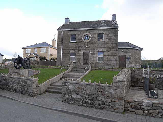
Memorial Hall, Ballinamuck
This hall, converted in 1948 into a Memorial Hall, was originally a Royal Irish Constabulary barracks built in the mid 19th century. Originally it was constructed as a fortress with two towers which have since been removed.
The Hall incorporates the Ballinamuck Visitor Centre which commemorates the Battle of Ballinamuck in 1798.
Following on the Irish Rebellion of 1798, a French invasion force landed near Killala in County Mayo on August 22, hoping to join forces with Irish rebels. After some initial successes, the French force of about 1000 men were confronted by overwhelmingly greater numbers of British troops at Ballinamuck and shortly surrendered. An Irish irregular force, including Irish deserters from the British army, continued to fight on and suffered heavy casualties. Whereas the French prisoners were treated honourably and repatriated, some 200 Irish including their General George Blake were hanged as traitors.a
![Creative Commons Licence [Some Rights Reserved]](https://s1.geograph.org.uk/img/somerights20.gif)
|
· Find out How to reuse this image ·
Share:
|
|||||
| Start a discussion on N1890 | Suggest an update to this image | Contact the contributor | |||
Loading map... (JavaScript required)
- Grid Square
- N1890, 5 images (more nearby
 )
)
- Photographer
- Oliver Dixon (find more nearby)
- Date Taken
- Friday, 8 May, 2009 (more nearby)
- Submitted
- Tuesday, 19 May, 2009
- Category
- Memorial hall (more nearby)
- Subject Location
-
Irish:
 N 187 907 [100m precision]
WGS84: 53:51.9433N 7:42.9535W - Camera Location
-
Irish: N 186 907
- View Direction
- EAST (about 90 degrees)
Image classification(about):
Geograph
This page has been viewed about 325 times.
View this location:
KML (Google Earth) ·
Google Maps ·
Bing Maps ·
Geograph Coverage Map ·
More Links for this image
·
Bing Maps ·
Geograph Coverage Map ·
More Links for this image