O0588 : Parish Church, Dunleer, Co. Louth
taken 15 years ago, near to Dunleer, Co Louth, Ireland
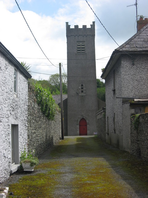
Parish Church, Dunleer, Co. Louth
The village of Dunleer is on the site of the Early Christian monastery of Lann Léire, associated with St. Brigid, founded by St. Forodran in the 6th or 7th century. The monastery was plundered by the Norsemen and others in the 10th and 12th centuries, being finally burnt in 1148. The Church of Ireland parish church and graveyard is down a lane off Main Street. Some early grave-slabs are preserved in the tower which dates to the 13th century. The rest of the church dates to 1830.
![Creative Commons Licence [Some Rights Reserved]](https://s1.geograph.org.uk/img/somerights20.gif)
|
· Find out How to reuse this image ·
Share:
|
|||||
| Start a discussion on O0588 | Suggest an update to this image | Contact the contributor | |||
Loading map... (JavaScript required)
- Grid Square
- O0588, 3 images (more nearby
 )
)
- Photographer
- Kieran Campbell (find more nearby)
- Date Taken
- Tuesday, 19 May, 2009 (more nearby)
- Submitted
- Tuesday, 19 May, 2009
- Category
- Religious buildings > Church (Church of Ireland) (more nearby)
- Subject Location
-
Irish:
 O 0578 8810 [10m precision]
WGS84: 53:49.9061N 6:23.6466W - Camera Location
-
Irish: O 0572 8808
- View Direction
- East-northeast (about 67 degrees)
Image classification(about):
Geograph (Second Visitor for O0588)
· First in 5 Years (TPoint) (about)
This page has been viewed about 465 times.
View this location:
KML (Google Earth) ·
Google Maps ·
Bing Maps ·
Geograph Coverage Map ·
More Links for this image
·
Bing Maps ·
Geograph Coverage Map ·
More Links for this image