H2994 : The River Finn viewed from Clady Bridge
taken 15 years ago, near to Clady, Co Tyrone, Northern Ireland
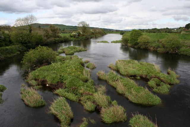
The River Finn viewed from Clady Bridge
A good salmon river, the Finn marks the boundary between Northern Ireland (on the right) and the Republic of Ireland (on the left).
![Creative Commons Licence [Some Rights Reserved]](https://s1.geograph.org.uk/img/somerights20.gif)
|
· Find out How to reuse this image ·
Share:
|
|||||
| Start a discussion on H2994 | Suggest an update to this image | Contact the contributor | |||
Loading map... (JavaScript required)
- Grid Square
- H2994, 36 images (more nearby
 )
)
- Photographer
- Des Colhoun (find more nearby)
- Date Taken
- Sunday, 17 May, 2009 (more nearby)
- Submitted
- Monday, 25 May, 2009
- Category
- River (more nearby)
- Subject Location
-
Irish:
 H 292 940 [100m precision]
WGS84: 54:47.5923N 7:32.7616W - Camera Location
-
Irish: H 292 940
- View Direction
- Northeast (about 45 degrees)
Image classification(about):
Geograph (Second Visitor for H2994)
This page has been viewed about 335 times.
View this location:
KML (Google Earth) ·
Google Maps ·
Bing Maps ·
Geograph Coverage Map ·
More Links for this image
·
Bing Maps ·
Geograph Coverage Map ·
More Links for this image