J5082 : The 'Long Hole', Bangor
taken 15 years ago, near to Bangor, Co Down, Northern Ireland
This is 1 of 15 images, with title The 'Long Hole', Bangor in this square
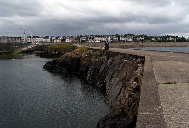
The 'Long Hole', Bangor
Another view of the 'Long Hole' at Bangor. This small harbour on the left, now disused, was created when stone was quarried out in the 19th Century - this picture should give an idea of the amount of stone excavated. Belfast Lough is seen to the right.
The remaining thin strip of rock has had concrete laid on top to give a fairly flat surface to walk/drive/land a helicopter on (see Link for some related images).
The remaining thin strip of rock has had concrete laid on top to give a fairly flat surface to walk/drive/land a helicopter on (see Link
The Long Hole
Also known as the 'Big Hole', this small harbour in Bangor, now silted up and disused, was created when stone was quarried out in the 19th Century.
![Creative Commons Licence [Some Rights Reserved]](https://s1.geograph.org.uk/img/somerights20.gif)
|
· Find out How to reuse this image ·
Share:
|
|||||
| Start a discussion on J5082 | Suggest an update to this image | Contact the contributor | |||
Loading map... (JavaScript required)
- Grid Square
- J5082, 2267 images (more nearby
 )
)
- Photographer
- Rossographer (find more nearby)
- Date Taken
- Saturday, 20 June, 2009 (more nearby)
- Submitted
- Monday, 29 June, 2009
- Category
- Harbour (disused) (more nearby)
- Subject Location
-
Irish:
 J 507 823 [100m precision]
WGS84: 54:40.0080N 5:39.8831W - Camera Location
-
Irish: J 507 823
- View Direction
- WEST (about 270 degrees)
Image classification(about):
Geograph
This page has been viewed about 76 times.
View this location:
KML (Google Earth) ·
Google Maps ·
Bing Maps ·
Geograph Coverage Map ·
More Links for this image