J2664 : Sundial
taken 15 years ago, near to Lisburn, Co Antrim, Northern Ireland
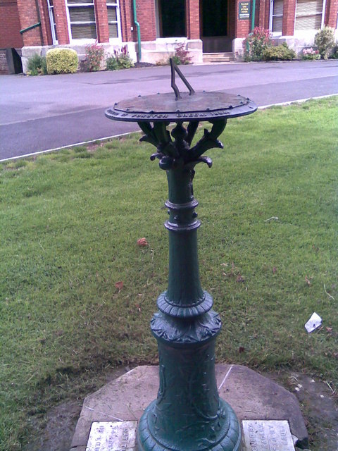
Sundial
This sundial is in the grounds of Friends' School, Lisburn. It is inscribed "Presented by Forster Green 1884". It has four plates on the base; latitude and longitude in degrees, minutes and seconds, name of the erector and height above sea level (208').
![Creative Commons Licence [Some Rights Reserved]](https://s1.geograph.org.uk/img/somerights20.gif)
|
· Find out How to reuse this image ·
Share:
|
|||||
| Start a discussion on J2664 | Suggest an update to this image | Contact the contributor | |||
Loading map... (JavaScript required)
- Grid Square
- J2664, 512 images (more nearby
 )
)
- Photographer
- Brian Shaw (find more nearby)
- Date Taken
- Thursday, 16 July, 2009 (more nearby)
- Submitted
- Thursday, 16 July, 2009
- Category
- Sundial (more nearby)
- Subject Location
-
Irish:
 J 267 649 [100m precision]
WGS84: 54:30.9990N 6:2.6563W - Camera Location
-
Irish: J 267 649
- View Direction
- North-northeast (about 22 degrees)
Image classification(about):
Supplemental image
This page has been viewed about 196 times.
View this location:
KML (Google Earth) ·
Google Maps ·
Bing Maps ·
Geograph Coverage Map ·
More Links for this image
·
Bing Maps ·
Geograph Coverage Map ·
More Links for this image