2009
SH5838 : Glaslyn estuary
taken 15 years ago, near to Portmeirion, Gwynedd, Wales
This is 1 of 2 images, with title Glaslyn estuary in this square
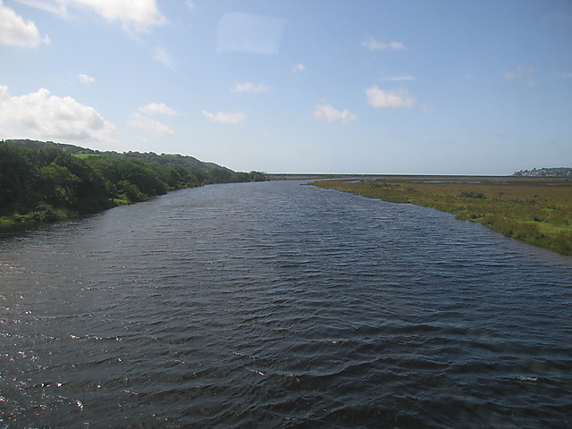
Glaslyn estuary
The Afon Glaslyn flows straight towards the Cob Link , the dam that closes off the Glaslyn estuary as part of an old land reclamation scheme. This picture was taken from the Cambrian Coast railway line as it crosses the estuary. The area between the two dams is saltmarsh (morfa), with improved land to the landward side of the dams (behind the camera).
 Map © Crown Copyright")
TIP: Click the map for more Large scale mapping
- Grid Square
- SH5838, 94 images (more nearby 🔍)
- Photographer
- Rudi Winter (more nearby)
- Date Taken
- Wednesday, 5 August, 2009 (more nearby)
- Submitted
- Friday, 7 August, 2009
- Subject Location
-
OSGB36:
 SH 582 380 [100m precision]
WGS84: 52:55.2386N 4:6.6351W - Camera Location
-
OSGB36: SH 588 390
- View Direction
- South-southwest (about 202 degrees)