V4798 : Stacks at Doonsheane Head
taken 21 years ago, 4 km SE of Dingle, Co Kerry, Ireland
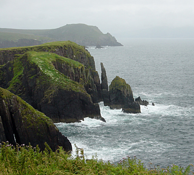
Stacks at Doonsheane Head
A short section of coastal path, where access is (unusually for this area) permitted for walkers, gives some precipitous views down the cliffs to the surging sea, particularly around this geo at Doonsheane Head where the waves have cut deeply into the cliffs, isolating a group of stacks. In the further distance, Bull's Head has similar features, including a more isolated stack.
![Creative Commons Licence [Some Rights Reserved]](https://s1.geograph.org.uk/img/somerights20.gif)
|
· Find out How to reuse this image ·
Share:
|
|||||
| Start a discussion on V4798 | Suggest an update to this image | Contact the contributor | |||
Loading map... (JavaScript required)
- Grid Square
- V4798, 2 images (more nearby
 )
)
- Photographer
- Andy Waddington (find more nearby)
- Date Taken
- Monday, 28 July, 2003 (more nearby)
- Submitted
- Tuesday, 24 November, 2009
- Category
- Stack (more nearby)
- Subject Location
-
Irish:
 V 477 985 [100m precision]
WGS84: 52:7.0735N 10:13.4535W - Camera Location
-
Irish: V 474 987
- View Direction
- East-southeast (about 112 degrees)
This page has been viewed about 74 times.
View this location:
KML (Google Earth) ·
Google Maps ·
Bing Maps ·
Geograph Coverage Map ·
More Links for this image
·
Bing Maps ·
Geograph Coverage Map ·
More Links for this image