J3581 : The Loughshore at Hazelbank, Whiteabbey
taken 14 years ago, near to Newtownabbey, Co Antrim, Northern Ireland
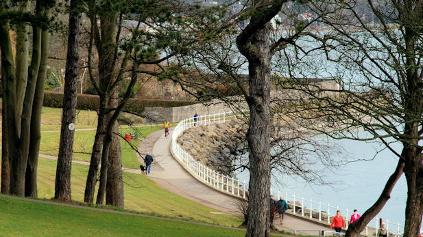
The Loughshore at Hazelbank, Whiteabbey
A coastal section of the park with the National Cycle Network route 93 passing along the shore.
Hazelbank Park, Newtownabbey
A park of about 25 acres between the Shore Road and Belfast Lough. It includes part of National Cycle Network route 93 (Newry to Ballycastle via the coast of Cos Down and Antrim).
![Creative Commons Licence [Some Rights Reserved]](https://s1.geograph.org.uk/img/somerights20.gif)
|
· Find out How to reuse this image ·
Share:
|
|||||
| Start a discussion on J3581 | Suggest an update to this image | Contact the contributor | |||
Loading map... (JavaScript required)
- Grid Square
- J3581, 47 images (more nearby
 )
)
- Photographer
- Albert Bridge (find more nearby)
- Date Taken
- Monday, 15 March, 2010 (more nearby)
- Submitted
- Monday, 15 March, 2010
- Category
- Park > Park (more nearby)
- Subject Location
-
Irish:
 J 355 814 [100m precision]
WGS84: 54:39.7602N 5:54.0240W - Camera Location
-
Irish: J 354 813
- View Direction
- Northeast (about 45 degrees)
Image classification(about):
Geograph
This page has been viewed about 294 times.
View this location:
KML (Google Earth) ·
Google Maps ·
Bing Maps ·
Geograph Coverage Map ·
More Links for this image
·
Bing Maps ·
Geograph Coverage Map ·
More Links for this image