J5980 : Dredging Donaghadee harbour 2010-1
taken 14 years ago, near to Donaghadee, Co Down, Northern Ireland
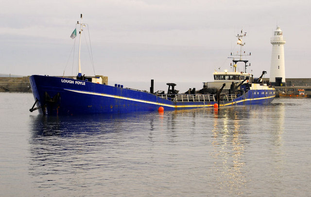
Dredging Donaghadee harbour 2010-1
See J5980 : The "Otterbank", Donaghadee and J5980 : The 'Otterbank' at Donaghadee. The trailing suction dredger Lough Foyle at work removing the silt disturbed by the Otterbanks rake. At 75 metres/246ft she is thought to be the biggest vessel ever to enter the harbour. Continue to J5980 : Dredging Donaghadee harbour 2010-2.
![Creative Commons Licence [Some Rights Reserved]](https://s1.geograph.org.uk/img/somerights20.gif)
|
· Find out How to reuse this image ·
Share:
|
|||||
| Start a discussion on J5980 | Suggest an update to this image | Contact the contributor | |||
Loading map... (JavaScript required)
- Grid Square
- J5980, 202 images (more nearby
 )
)
- Photographer
- Albert Bridge (find more nearby)
- Date Taken
- Friday, 9 April, 2010 (more nearby)
- Submitted
- Friday, 9 April, 2010
- Category
- Boat (more nearby)
- Subject Location
-
Irish:
 J 593 801 [100m precision]
WGS84: 54:38.6758N 5:31.9741W - Camera Location
-
Irish: J 591 800
- View Direction
- Northeast (about 45 degrees)
Image classification(about):
Geograph
This page has been viewed about 239 times.
View this location:
KML (Google Earth) ·
Google Maps ·
Bing Maps ·
Geograph Coverage Map ·
More Links for this image
·
Bing Maps ·
Geograph Coverage Map ·
More Links for this image