N9194 : Church at Churchtown, Co. Louth
taken 14 years ago, near to Edmondstown, Co Louth, Ireland
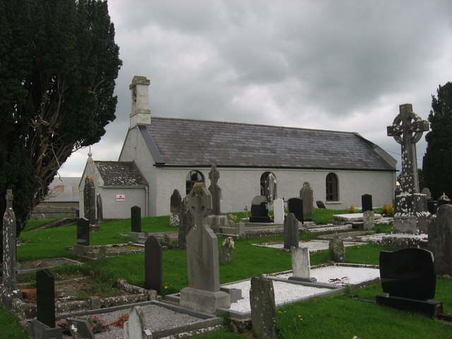
Church at Churchtown, Co. Louth
Originally a monastic site founded in the 6th century. Some of the medieval structure is retained in the 19th century church, now used as a community hall. Marked as 'Clonkeen Ch', after the parish name, on Taylor and Skinner's map 1778 and as 'St. Medoc's Church' on the O.S. six-inch map.
![Creative Commons Licence [Some Rights Reserved]](https://s1.geograph.org.uk/img/somerights20.gif)
|
· Find out How to reuse this image ·
Share:
|
|||||
| Start a discussion on N9194 | Suggest an update to this image | Contact the contributor | |||
Loading map... (JavaScript required)
- Grid Square
- N9194 (more nearby
 )
)
- Photographer
- Kieran Campbell (find more nearby)
- Date Taken
- Thursday, 6 May, 2010 (more nearby)
- Submitted
- Friday, 7 May, 2010
- Category
- Church or chapel (converted) (more nearby)
- Subject Location
-
Irish:
 N 9115 9407 [10m precision]
WGS84: 53:53.2894N 6:36.8681W - Camera Location
-
Irish: N 9115 9407
- View Direction
- NORTH (about 0 degrees)
This page has been viewed about 249 times.
View this location:
KML (Google Earth) ·
Google Maps ·
Bing Maps ·
Geograph Coverage Map ·
More Links for this image
·
Bing Maps ·
Geograph Coverage Map ·
More Links for this image