C1928 : Milford Flour Mill
taken 14 years ago, near to Millford, Co Donegal, Ireland
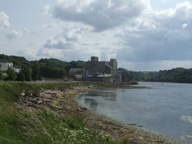
Milford Flour Mill
The disused mill had its own quay.
![Creative Commons Licence [Some Rights Reserved]](https://s1.geograph.org.uk/img/somerights20.gif)
|
· Find out How to reuse this image ·
Share:
|
|||||
| Start a discussion on C1928 | Suggest an update to this image | Contact the contributor | |||
Loading map... (JavaScript required)
- Grid Square
- C1928, 7 images (more nearby
 )
)
- Photographer
- John M (find more nearby)
- Date Taken
- Saturday, 26 June, 2010 (more nearby)
- Submitted
- Saturday, 26 June, 2010
- Category
- Mill (disused) (more nearby)
- Subject Location
-
Irish:
 C 197 282 [100m precision]
WGS84: 55:6.0736N 7:41.4441W - Camera Location
-
Irish: C 199 287
- View Direction
- South-southwest (about 202 degrees)
Image classification(about):
Geograph (Third Visitor for C1928)
This page has been viewed about 136 times.
View this location:
KML (Google Earth) ·
Google Maps ·
Bing Maps ·
Geograph Coverage Map ·
More Links for this image
·
Bing Maps ·
Geograph Coverage Map ·
More Links for this image