1995
SK5192 : Surveying the water tower
taken 29 years ago, near to Hooton Levitt, Rotherham, England
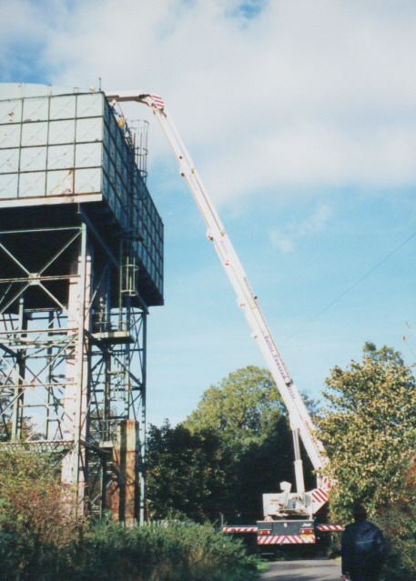
Surveying the water tower
A 'Bronto skylift' (allegedly the biggest hydraulic platform in the UK) being used to survey the water tower in Lilley Hall Lane. The tower was leaning dangerously due to mining subsidence and was subsequently demolished.
 Map © Crown Copyright")
TIP: Click the map for more Large scale mapping
- Grid Square
- SK5192, 13 images (more nearby 🔍)
- Photographer
- Stephen Craven (more nearby)
- Date Taken
- Wednesday, 18 October, 1995 (more nearby)
- Submitted
- Monday, 17 July, 2006
- Subject Location
-
OSGB36:
 SK 517 926 [100m precision]
WGS84: 53:25.6599N 1:13.4040W - View Direction
- Northwest (about 315 degrees)