J3474 : Queen Elizabeth Bridge traffic, Belfast
taken 14 years ago, near to Belfast, Co Antrim, Northern Ireland
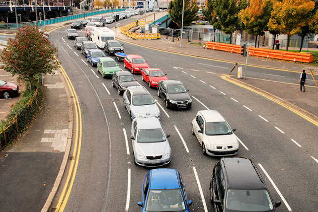
Queen Elizabeth Bridge traffic, Belfast
See J3474 : Middlepath Street traffic, Belfast. The same queue, stretching over the Queen Elizabeth Bridge, back to who-knows-where?
The Queen Elizabeth Bridge, Belfast
The Queen Elizabeth bridge, across the River Lagan, opened in 1966. Part of a one-way system, it is used by outward traffic heading towards the Sydenham bypass (for north Down), east Belfast, Newtownards and the Ards Peninsula.
![Creative Commons Licence [Some Rights Reserved]](https://s1.geograph.org.uk/img/somerights20.gif)
|
· Find out How to reuse this image ·
Share:
|
|||||
|
There are 4 posts in a
discussion on J3474 (preview on the left) |
Suggest an update to this image | Contact the contributor | |||
Loading map... (JavaScript required)
- Grid Square
- J3474, 4349 images (more nearby
 )
)
- Photographer
- Albert Bridge (find more nearby)
- Date Taken
- Sunday, 17 October, 2010 (more nearby)
- Submitted
- Sunday, 17 October, 2010
- Category
- Traffic jam (more nearby)
- Subject Location
-
Irish:
 J 344 744 [100m precision]
WGS84: 54:36.0186N 5:55.2567W - Camera Location
-
Irish: J 346 744
- View Direction
- West-southwest (about 247 degrees)
Image classification(about):
Geograph
This page has been viewed about 341 times.
View this location:
KML (Google Earth) ·
Google Maps ·
Bing Maps ·
Geograph Coverage Map ·
More Links for this image
·
Bing Maps ·
Geograph Coverage Map ·
More Links for this image