NM1596 : Hyskeir lighthouse
taken 37 years ago, near to Camas na Cloiche Ruadhe [water Feature], Highland, Great Britain
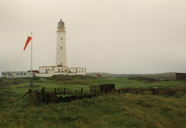
Taken on a visit in August 1987, with permission from the Northern Lighthouse Board to travel on one of their resupply trips by helicopter from Oban. My visit was part of the field work to investigate possible locations for wind speed measurements at an exposed coastal site, as comparison data for radar instruments on the ERS-1 satellite. The European Remote Sensing satellite was launched in 1991 by the European Space Agency; its package of instruments for precision altimetry, radar imaging and measurement of sea surface temperature and ocean winds. ERS-1 continued operating to March 2000, well beyond its design life. For more information, please see the ESA website Link
The lighthouse was opened by the Northern Lighthouse Board in 1904 to mark these low-lying islands W of Rum. It was manned at the time of my visit, but was automated in March 1997. Please see the Northern Lighthouse Board's site Linkfor more background on this and other lighthouses.
 Map © Crown Copyright")
- Grid Square
- NM1596, 11 images (more nearby 🔍)
- Photographer
- Jim Barton (more nearby)
- Date Taken
- Thursday, 20 August, 1987 (more nearby)
- Submitted
- Saturday, 20 November, 2010
- Subject Location
-
OSGB36:
 NM 156 961 [100m precision]
WGS84: 56:58.1442N 6:40.8623W - Camera Location
-
OSGB36: NM 156 961
- View Direction
- NORTH (about 0 degrees)