J3676 : Radar, George Best Belfast City Airport
taken 13 years ago, 4 km NE of Belfast, Co Antrim, Northern Ireland
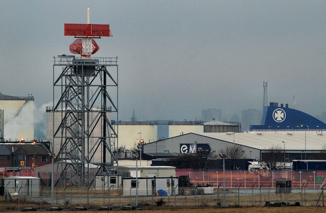
Radar, George Best Belfast City Airport
The radar installation on the north western side of the runway. J3676 : Radar, George Best Belfast City Airport (April 2015) shows the view from the embankment on the northern side of Victoria Park.
![Creative Commons Licence [Some Rights Reserved]](https://s1.geograph.org.uk/img/somerights20.gif)
|
· Find out How to reuse this image ·
Share:
|
|||||
| Start a discussion on J3676 | Suggest an update to this image | Contact the contributor | |||
Loading map... (JavaScript required)
- Grid Square
- J3676, 338 images (more nearby
 )
)
- Photographer
- Albert Bridge (find more nearby)
- Date Taken
- Monday, 10 January, 2011 (more nearby)
- Submitted
- Monday, 10 January, 2011
- Geographical Context
- Primary Subject of Photo
- Place (from Tags)
- Category
- Radar station (more nearby)
- Subject Location
-
Irish:
 J 369 762 [100m precision]
WGS84: 54:36.9471N 5:52.8407W - Camera Location
-
Irish: J 371 755
- View Direction
- North-northwest (about 337 degrees)
Other Tags
Image classification(about):
Supplemental image
This page has been viewed about 155 times.
View this location:
KML (Google Earth) ·
Google Maps ·
Bing Maps ·
Geograph Coverage Map ·
More Links for this image
·
Bing Maps ·
Geograph Coverage Map ·
More Links for this image