S0209 : Knockmealdown wall
taken 18 years ago, 5 km SSE of Clogheen, Co Tipperary, Ireland
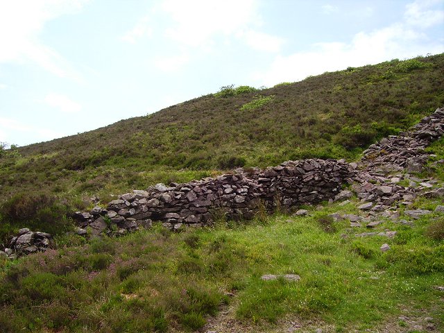
Knockmealdown wall
Tipperary - Waterford boundary wall running west from The Gap. I followed the wall some way up the steep slopes of Knocknalougha until I got into the square (typical corner visiting)
Amongst the heather, stray rhododendrons are getting established. It is quite possible that soon there will be no access to the hill from this side.
Never descend unseen north from Knocknalougha, the northern slopes are largely impenetrable.
Amongst the heather, stray rhododendrons are getting established. It is quite possible that soon there will be no access to the hill from this side.
Never descend unseen north from Knocknalougha, the northern slopes are largely impenetrable.
![Creative Commons Licence [Some Rights Reserved]](https://s1.geograph.org.uk/img/somerights20.gif)
|
· Find out How to reuse this image ·
Share:
|
|||||
| Start a discussion on S0209 | Suggest an update to this image | Contact the contributor | |||
Loading map... (JavaScript required)
- Grid Square
- S0209, 3 images (more nearby
 )
)
- Photographer
- Richard Webb (find more nearby)
- Date Taken
- Sunday, 25 June, 2006 (more nearby)
- Submitted
- Friday, 8 September, 2006
- Category
- Dyke (more nearby)
- Subject Location
-
Irish:
 S 029 099 [100m precision]
WGS84: 52:14.4783N 7:57.4965W - View Direction
- Southwest (about 225 degrees)
This page has been viewed about 74 times.
View this location:
KML (Google Earth) ·
Google Maps ·
Bing Maps ·
Geograph Coverage Map ·
More Links for this image
·
Bing Maps ·
Geograph Coverage Map ·
More Links for this image