B9927 : South descent on Muckish
taken 13 years ago, 7 km SSE of Ballyboe, Co Donegal, Ireland
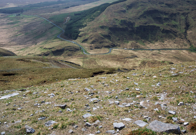
South descent on Muckish
The easiest route up and down Muckish Mountain is from the south. An hours climb from the parking spot near a grotto on the R256 (the bend in the road seen below) gives way to a long flat plateau. This is the view on the descent - the quartzite boulders soon give way to springy peat all the way down to the road.
![Creative Commons Licence [Some Rights Reserved]](https://s1.geograph.org.uk/img/somerights20.gif)
|
· Find out How to reuse this image ·
Share:
|
|||||
| Start a discussion on B9927 | Suggest an update to this image | Contact the contributor | |||
Loading map... (JavaScript required)
- Grid Square
- B9927, 8 images (more nearby
 )
)
- Photographer
- Rossographer (find more nearby)
- Date Taken
- Tuesday, 26 April, 2011 (more nearby)
- Submitted
- Tuesday, 3 May, 2011
- Geographical Context
- Subject Location
-
Irish:
 B 998 277 [100m precision]
WGS84: 55:5.8223N 8:0.1673W - Camera Location
-
Irish: B 998 278
- View Direction
- SOUTH (about 180 degrees)
Other Tags
Image classification(about):
Geograph (Second Visitor for B9927)
· First in 5 Years (TPoint) (about)
This page has been viewed about 107 times.
View this location:
KML (Google Earth) ·
Google Maps ·
Bing Maps ·
Geograph Coverage Map ·
More Links for this image
·
Bing Maps ·
Geograph Coverage Map ·
More Links for this image