J5985 : Lighthouse Island
taken 14 years ago, 6 km N of Donaghadee, Co Down, Northern Ireland
This is 1 of 3 images, with title Lighthouse Island in this square
Lighthouse Island
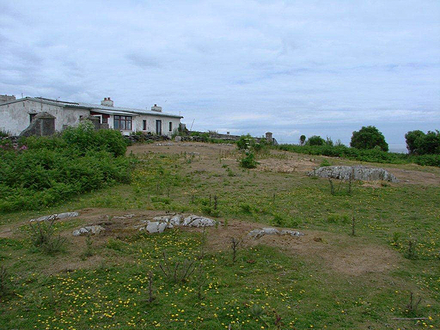
Lighthouse Island is one of the Copeland Islands off the coast of north County Down. According to Wikipedia "In 1671 James Ross obtained a fee farm grant of these and in 1770 David Kerr purchased the islands from the Earl of Clanbrassil. As the islands were a danger to ships a light beacon was made on the Lighthouse Island (Cross Island) in about 1715, it burned over 400 tons of coal every year. In 1796 the new British and Irish Lighthouse Board announced the erection of oil lamps and in 1813 the new lighthouse was built. Over a century ago the island had a population of about 100, including a school master with 28 pupils" Link . The island no longer has a lighthouse - instead a new light was established on nearby Mew Island in 1884 J6086 : Mew Island Lighthouse. Instead, Lighthouse Island is now home to the Copeland Bird Observatory - see Link (Archive Link ) - as the islands are now an Area of Special Scientific Interest (ASSI) and support a wide variety of breeding birds. Contact the observatory at the above address if you wish to visit. The picture shows the only habitable accommodation on the island, located in the converted ruins of the old lighthouse.
![Creative Commons Licence [Some Rights Reserved]](https://s1.geograph.org.uk/img/somerights20.gif)
|
· Find out How to reuse this image ·
Share:
|
|||||
| Start a discussion on J5985 | Suggest an update to this image | Contact the contributor | |||
Loading map... (JavaScript required)
- Grid Square
- J5985, 21 images (more nearby
 )
)
- Photographer
- © N McKee (find more nearby)
- Contributed by
- Rossographer (find more nearby)
- Date Taken
- Saturday, 26 June, 2010 (more nearby)
- Submitted
- Friday, 3 June, 2011
- Geographical Context
- Place (from Tags)
- Subject Location
-
Irish:
 J 596 859 [100m precision]
WGS84: 54:41.7543N 5:31.4428W - Camera Location
-
Irish: J 596 858
- View Direction
- NORTH (about 0 degrees)
Other Tags
This page has been viewed about 147 times.
View this location:
KML (Google Earth) ·
Google Maps ·
Bing Maps ·
Geograph Coverage Map ·
More Links for this image