J5985 : Old lighthouse, Lighthouse Island
taken 13 years ago, 6 km N of Donaghadee, Co Down, Northern Ireland
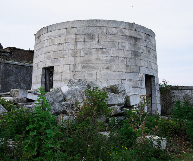
Lighthouse Island is one of the Copeland Islands, off the north eastern coast of Co Down, close to Donaghadee and the entrance to Belfast Lough. The following is a condensed version of a Wikipedia article: in 1671 James Ross obtained a fee farm grant of these. In 1770 David Kerr bought the islands from the Earl of Clanbrassil. A light beacon was established circa 1715 on what is now Lighthouse Island followed by a permanent lighthouse in 1813. In 1884 the lighthouse, which still exists, was replaced by one on nearby Mew Island. No longer inhabited, Lighthouse Island is now home to the Copeland Bird Observatory. This is the link to the full Wiki article Link
. Also useful Irish Lights Link
![Creative Commons Licence [Some Rights Reserved]](https://s1.geograph.org.uk/img/somerights20.gif)
|
· Find out How to reuse this image ·
Share:
|
|||||
| Start a discussion on J5985 | Suggest an update to this image | Contact the contributor | |||
- Grid Square
- J5985, 21 images (more nearby
 )
)
- Photographer
- Rossographer (find more nearby)
- Date Taken
- Tuesday, 14 June, 2011 (more nearby)
- Submitted
- Friday, 17 June, 2011
- Geographical Context
- Place (from Tags)
- Subject Location
-
Irish:
 J 596 859 [100m precision]
WGS84: 54:41.7653N 5:31.4515W - Camera Location
-
Irish: J 596 859
- View Direction
- NORTH (about 0 degrees)
Other Tags