2008
NZ0443 : Waskerley Beck
taken 16 years ago, near to Waskerley, County Durham, England
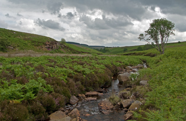
Waskerley Beck
Waskerley Beck is seen here below Waskerley Reservoir and so perhaps with a reduced flow. It continues eastwards then turns south to find another reservoir, (Tunstall), in its path before completing its journey to join the River Wear at Wolsingham.
 Map © Crown Copyright")
TIP: Click the map for more Large scale mapping
- Grid Square
- NZ0443, 5 images (more nearby 🔍)
- Photographer
- Trevor Littlewood (more nearby)
- Date Taken
- Wednesday, 9 July, 2008 (more nearby)
- Submitted
- Saturday, 25 June, 2011
- Subject Location
-
OSGB36:
 NZ 0440 4381 [10m precision]
WGS84: 54:47.3500N 1:55.9860W - Camera Location
-
OSGB36: NZ 0433 4387
- View Direction
- Southeast (about 135 degrees)