Q6114 : Caisleán Ghriaire (Castlegregory): The Trench
taken 18 years ago, near to Castlegregory, Co Kerry, Ireland
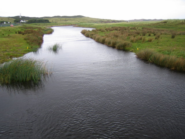
Caisleán Ghriaire (Castlegregory): The Trench
Viewed from Trench Bridge, The Trench is the river that is the outflow from Lough Gill, and swings around to the right in the distance to flow out into Tralee Bay. The water level in Lough Gill is maintained by one way flap valves in the bridge
![Creative Commons Licence [Some Rights Reserved]](https://s1.geograph.org.uk/img/somerights20.gif)
|
· Find out How to reuse this image ·
Share:
|
|||||
| Start a discussion on Q6114 | Suggest an update to this image | Contact the contributor | |||
Loading map... (JavaScript required)
- Grid Square
- Q6114, 4 images (more nearby
 )
)
- Photographer
- Nigel Cox (find more nearby)
- Date Taken
- Thursday, 5 October, 2006 (more nearby)
- Submitted
- Monday, 9 October, 2006
- Category
- River (more nearby)
- Subject Location
-
Irish:
 Q 617 149 [100m precision]
WGS84: 52:16.1315N 10:1.6000W - View Direction
- NORTH (about 0 degrees)
This page has been viewed about 304 times.
View this location:
KML (Google Earth) ·
Google Maps ·
Bing Maps ·
Geograph Coverage Map ·
More Links for this image
·
Bing Maps ·
Geograph Coverage Map ·
More Links for this image