C6138 : Captain Ramsay's House / The Ark, Moville
taken 13 years ago, near to Moville, Co Donegal, Ireland
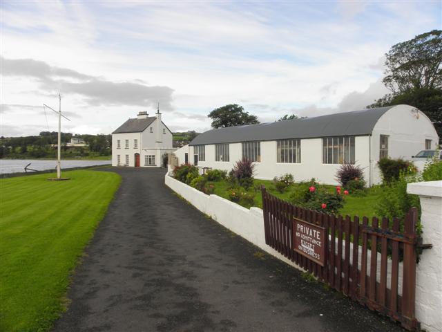
Captain Ramsay's House / The Ark, Moville
The story goes that the most romantic event during the years 1820-1830 was the advent of the "Ark." Sometime between 1820 and 1830 Captain Ramsay, R.N., bought an old brig in Derry and had it towed to Moville. He dug a channel in the sand and dragged it up above high water mark, and converted it into a dwelling, living rent free, I suppose. The land on which it stood had long ago disappeared under the waves.
Captain Ramsay gave a dance as a house warming on the occasion of his taking possession of his home, and two ladies, Mrs. Brown and her sister, Miss Grierson, were present at the ball. It was at this dance also that Captain Ramsay met the lady who became his wife.
In due time, Captain Ramsay went to serve on the Chile or Brazil Coast, under that most dashing of commanders, Lord Dundonald. And this seems to fix a date for the Ark, for Dundonald seems to have haunted the West of South America from 1823 to 1825, transferring his attentions after that to Brazil until 1827.
On his return home, Ramsay found the Ark in a very neglected state, owing to an idle caretaker. Moreover, the lady whom he had married practically refused to live in the Ark Whereupon, probably about the year 1833, he broke up the brig and built the present Ark House, the timber in it being entirely taken from the ship.
More at Link
![Creative Commons Licence [Some Rights Reserved]](https://s1.geograph.org.uk/img/somerights20.gif)
|
· Find out How to reuse this image ·
Share:
|
|||||
| Start a discussion on C6138 | Suggest an update to this image | Contact the contributor | |||
Loading map... (JavaScript required)
- Grid Square
- C6138, 114 images (more nearby
 )
)
- Photographer
- Kenneth Allen (find more nearby)
- Date Taken
- Saturday, 3 September, 2011 (more nearby)
- Submitted
- Tuesday, 6 September, 2011
- Geographical Context
- Subject Location
-
Irish:
 C 610 381 [100m precision]
WGS84: 55:11.1850N 7:2.5021W - Camera Location
-
Irish: C 611 381
- View Direction
- South-southwest (about 202 degrees)
Other Tags
Image classification(about):
Geograph
This page has been viewed about 331 times.
View this location:
KML (Google Earth) ·
Google Maps ·
Bing Maps ·
Geograph Coverage Map ·
More Links for this image