C2737 : Martello tower, Binnadreen
taken 13 years ago, 3 km from Glenvar, Co Donegal, Ireland
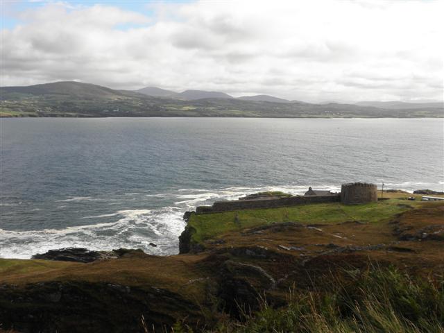
Martello tower, Binnadreen
Looking east in the direction of the Swilly, see close-up here C2737 : Martello Tower
![Creative Commons Licence [Some Rights Reserved]](https://s1.geograph.org.uk/img/somerights20.gif)
|
· Find out How to reuse this image ·
Share:
|
|||||
| Start a discussion on C2737 | Suggest an update to this image | Contact the contributor | |||
Loading map... (JavaScript required)
- Grid Square
- C2737, 5 images (more nearby
 )
)
- Photographer
- Kenneth Allen (find more nearby)
- Date Taken
- Wednesday, 14 September, 2011 (more nearby)
- Submitted
- Friday, 16 September, 2011
- Geographical Context
- Subject Location
-
Irish:
 C 271 371 [100m precision]
WGS84: 55:10.8329N 7:34.4662W - Camera Location
-
Irish: C 269 371
- View Direction
- EAST (about 90 degrees)
Other Tags
Image classification(about):
Supplemental image
This page has been viewed about 36 times.
View this location:
KML (Google Earth) ·
Google Maps ·
Bing Maps ·
Geograph Coverage Map ·
More Links for this image
·
Bing Maps ·
Geograph Coverage Map ·
More Links for this image