N8869 : Donaghmore Round Tower
taken 13 years ago, near to Donaghmore, Co Meath, Ireland
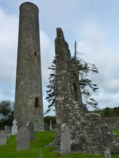
Donaghmore Round Tower
To the right of the 11th century round tower are vestigial ruins of the associated church.
![Creative Commons Licence [Some Rights Reserved]](https://s1.geograph.org.uk/img/somerights20.gif)
|
· Find out How to reuse this image ·
Share:
|
|||||
| Start a discussion on N8869 | Suggest an update to this image | Contact the contributor | |||
Loading map... (JavaScript required)
- Grid Square
- N8869, 4 images (more nearby
 )
)
- Photographer
- James Allan (find more nearby)
- Date Taken
- Friday, 7 October, 2011 (more nearby)
- Submitted
- Wednesday, 12 October, 2011
- Geographical Context
- Subject Location
-
Irish:
 N 883 698 [100m precision]
WGS84: 53:40.2819N 6:39.8195W - Camera Location
-
Irish: N 884 697
- View Direction
- North-northwest (about 337 degrees)
Other Tags
Image classification(about):
Geograph (Third Visitor for N8869)
This page has been viewed about 85 times.
View this location:
KML (Google Earth) ·
Google Maps ·
Bing Maps ·
Geograph Coverage Map ·
More Links for this image
·
Bing Maps ·
Geograph Coverage Map ·
More Links for this image