J3583 : The Three Mile Water, Whiteabbey (2)
taken 12 years ago, near to Whiteabbey, Co Antrim, Northern Ireland
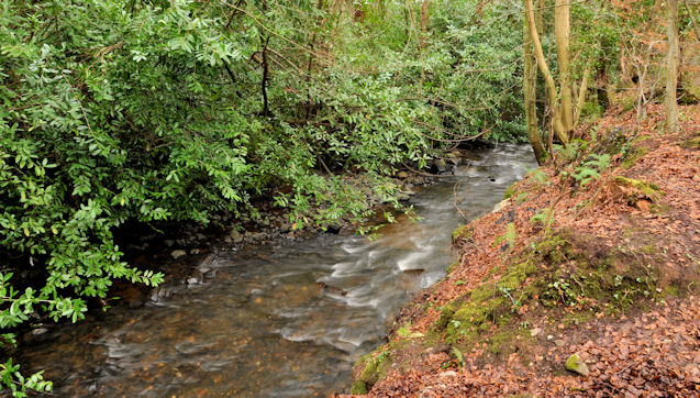
The Three Mile Water, Whiteabbey (2)
The Three Mile Water, looking downstream, through The Glen, to the east of the railway viaducts.
The Glen Park, Whiteabbey :: J3582
A park, owned by Newtownabbey Borough Council, based around the glen of the Three Mile Water, between Bleach Green Viaduct and the Glenville Road, (off the Shore Road at Whiteabbey). The area is now called The Glen though it seems originally to have been Valentines Glen. The Three Mile Water rises between Mossley and Doagh before flowing into Belfast Lough at Whiteabbey.
![Creative Commons Licence [Some Rights Reserved]](https://s1.geograph.org.uk/img/somerights20.gif)
|
· Find out How to reuse this image ·
Share:
|
|||||
| Start a discussion on J3583 | Suggest an update to this image | Contact the contributor | |||
Loading map... (JavaScript required)
- Grid Square
- J3583, 49 images (more nearby
 )
)
- Photographer
- Albert Bridge (find more nearby)
- Date Taken
- Wednesday, 1 February, 2012 (more nearby)
- Submitted
- Wednesday, 1 February, 2012
- Geographical Context
- Subject Location
-
Irish:
 J 354 834 [100m precision]
WGS84: 54:40.8329N 5:54.0152W - Camera Location
-
Irish: J 354 834
- View Direction
- Southeast (about 135 degrees)
Other Tags
Image classification(about):
Geograph
This page has been viewed about 147 times.
View this location:
KML (Google Earth) ·
Google Maps ·
Bing Maps ·
Geograph Coverage Map ·
More Links for this image
·
Bing Maps ·
Geograph Coverage Map ·
More Links for this image