1990
SZ6398 : The shoreline at Southsea in 1990
taken 34 years ago, near to Southsea, Portsmouth, England
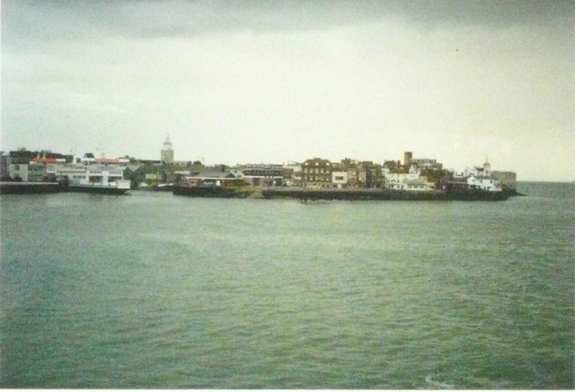
The shoreline at Southsea in 1990
Seen from a Cherbourg to Portsmouth ferry early in the morning. I had been booked to sail from St Malo the previous evening but when I arrived at the port to board the boat, an announcement was made that it had developed an engine fault. As I was a foot passenger, a coach was laid on to take my fellow travellers and me to Cherbourg, while drivers of other vehicles had to make their own ways. I travelled with Brittany Ferries and the return fare for the crossing was £62.00.
 Map © Crown Copyright")
TIP: Click the map for more Large scale mapping
- Grid Square
- SZ6398, 591 images (more nearby 🔍)
- Photographer
- John Baker (more nearby)
- Date Taken
- Sunday, 23 September, 1990 (more nearby)
- Submitted
- Thursday, 14 June, 2012
- Subject Location
-
OSGB36:
 SZ 6381 9842 [10m precision]
WGS84: 50:46.9112N 1:5.7753W - Camera Location
-
OSGB36: SZ 6319 9843
- View Direction
- EAST (about 90 degrees)