J2868 : Former Dunmurry Presbyterian church, Dunmurry (2)
taken 12 years ago, near to Dunmurry, Co Antrim, Northern Ireland
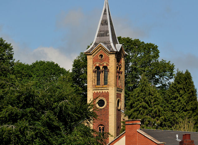
Former Dunmurry Presbyterian church, Dunmurry (2)
The tower and spire seen from the Glenburn Road car park. No sign, yet, of any work starting to convert the church for residential use.
Former Presbyterian church, Dunmurry
The church was completed in 1863 replacing a temporary building which seems to have been used since 1860. The listed building is no longer a church having been replaced a new building on the other side of Kingsway. There is a planning permission (March 2011) as follows S/2009/0789/F Change of use and alterations to listed church building - conversion to 9 supported apartments and insertion of new windows and internal floor.
![Creative Commons Licence [Some Rights Reserved]](https://s1.geograph.org.uk/img/somerights20.gif)
|
· Find out How to reuse this image ·
Share:
|
|||||
| Start a discussion on J2868 | Suggest an update to this image | Contact the contributor | |||
Loading map... (JavaScript required)
- Grid Square
- J2868, 67 images (more nearby
 )
)
- Photographer
- Albert Bridge (find more nearby)
- Date Taken
- Tuesday, 19 June, 2012 (more nearby)
- Submitted
- Tuesday, 19 June, 2012
- Geographical Context
- Subject Location
-
Irish:
 J 289 687 [100m precision]
WGS84: 54:33.0330N 6:0.4445W - Camera Location
-
Irish: J 289 686
- View Direction
- NORTH (about 0 degrees)
Other Tags
Image classification(about):
Geograph
This page has been viewed about 366 times.
View this location:
KML (Google Earth) ·
Google Maps ·
Bing Maps ·
Geograph Coverage Map ·
More Links for this image
·
Bing Maps ·
Geograph Coverage Map ·
More Links for this image