2012
ST4677 : The Fault with Port's Head
taken 12 years ago, near to Portishead, North Somerset, England
The Fault with Port's Head
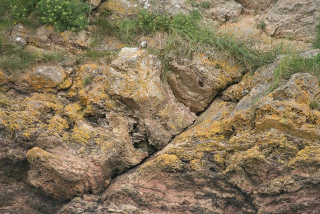
We site betwixt a deep channel scour the original name along the Malvern fault south and a promontory that protects from deflected Severn Wye Avon Avon scour in flood stream, possibly a result of foundering when it used to be west side of The Denny, and yet Port's Head The Battery is sheared and this the large dipping west or south west it provides a slide and erosion zone.
 Map © Crown Copyright")
TIP: Click the map for more Large scale mapping
- Grid Square
- ST4677, 209 images (more nearby 🔍)
- Photographer
- Michael Dennis Stagg (more nearby)
- Date Taken
- Friday, 20 July, 2012 (more nearby)
- Submitted
- Friday, 20 July, 2012
- Subject Location
-
OSGB36:
 ST 4643 7753 [10m precision]
WGS84: 51:29.6497N 2:46.3822W - Camera Location
-
OSGB36: ST 4640 7724
- View Direction
- NORTH (about 0 degrees)