V9935 : 12 Arch Bridge in Ballydehob
taken 17 years ago, near to Ballydehob, Co Cork, Ireland
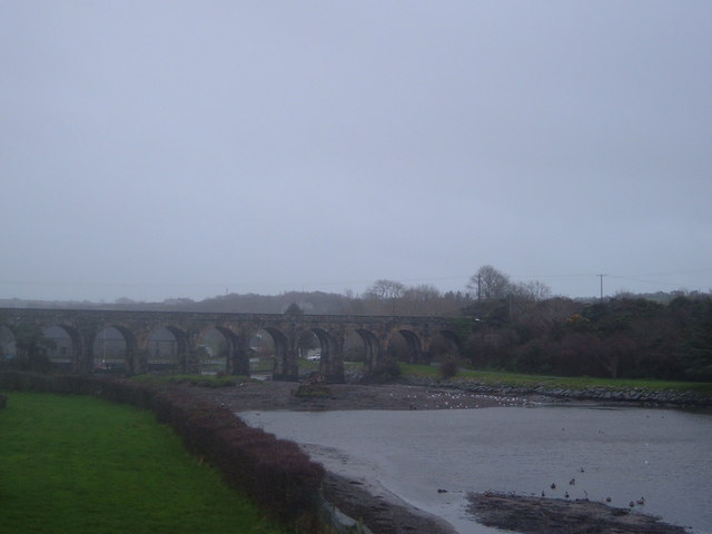
12 Arch Bridge in Ballydehob
Former Schull & Skibbereen Railway viaduct, now a footbridge. This 3'0" narrow gauge line closed in 1947 during the fuel crisis of that year. It never re-opened.
![Creative Commons Licence [Some Rights Reserved]](https://s1.geograph.org.uk/img/somerights20.gif)
|
· Find out How to reuse this image ·
Share:
|
|||||
| Start a discussion on V9935 | Suggest an update to this image | Contact the contributor | |||
Loading map... (JavaScript required)
- Grid Square
- V9935, 27 images (more nearby
 )
)
- Photographer
- Dr Brian Lynch (find more nearby)
- Date Taken
- Wednesday, 3 January, 2007 (more nearby)
- Submitted
- Friday, 5 January, 2007
- Category
- Bridge (more nearby)
- Subject Location
-
Irish:
 V 990 352 [100m precision]
WGS84: 51:33.6772N 9:27.4286W - Camera Location
-
Irish: V 990 354
- View Direction
- SOUTH (about 180 degrees)
Image classification(about):
Geograph
This page has been viewed about 261 times.
View this location:
KML (Google Earth) ·
Google Maps ·
Bing Maps ·
Geograph Coverage Map ·
More Links for this image
·
Bing Maps ·
Geograph Coverage Map ·
More Links for this image