H0395 : Bog, Altnaguinea
taken 12 years ago, 3 km from Commeen, Co Donegal, Ireland
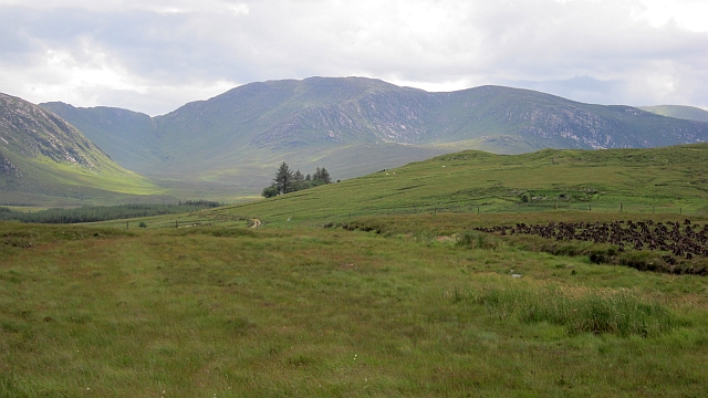
Bog, Altnaguinea
Turf cuttings under Altnapaste with peats stacked and drying. The view is towards exposed granite on the Bluestack Mountains.
![Creative Commons Licence [Some Rights Reserved]](https://s1.geograph.org.uk/img/somerights20.gif)
|
· Find out How to reuse this image ·
Share:
|
|||||
| Start a discussion on H0395 | Suggest an update to this image | Contact the contributor | |||
Loading map... (JavaScript required)
- Grid Square
- H0395, 2 images (more nearby
 )
)
- Photographer
- Richard Webb (find more nearby)
- Date Taken
- Thursday, 19 July, 2012 (more nearby)
- Submitted
- Friday, 27 July, 2012
- Geographical Context
- Subject Location
-
Irish:
 H 037 951 [100m precision]
WGS84: 54:48.2677N 7:56.5275W - Camera Location
-
Irish: H 038 951
- View Direction
- WEST (about 270 degrees)
Other Tags
This page has been viewed about 26 times.
View this location:
KML (Google Earth) ·
Google Maps ·
Bing Maps ·
Geograph Coverage Map ·
More Links for this image
·
Bing Maps ·
Geograph Coverage Map ·
More Links for this image