J4968 : The Loughshore near Comber (11)
taken 12 years ago, 3 km from Comber, Co Down, Northern Ireland
The Loughshore near Comber (11)
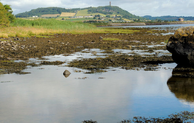
The shore of Strangford Lough, at Island Hill, Ringcreevy at the start of the causeway to Rough Island J4968 : Causeway to Rough Island (11). Mostly inter-tidal mud with large pebbles and the occasional boulder such as this one J4968 : Boulder, Strangford Lough (right). The causeway is not shown on the Google map. Taken approximately 2½ hours after high water, Killyleagh.
![Creative Commons Licence [Some Rights Reserved]](https://s1.geograph.org.uk/img/somerights20.gif)
|
· Find out How to reuse this image ·
Share:
|
|||||
| Start a discussion on J4968 | Suggest an update to this image | Contact the contributor | |||
Loading map... (JavaScript required)
- Grid Square
- J4968, 73 images (more nearby
 )
)
- Photographer
- Albert Bridge (find more nearby)
- Date Taken
- Saturday, 28 July, 2012 (more nearby)
- Submitted
- Saturday, 28 July, 2012
- Geographical Context
- Subject Location
-
Irish:
 J 491 689 [100m precision]
WGS84: 54:32.8256N 5:41.7870W - Camera Location
-
Irish: J 491 689
- View Direction
- Northwest (about 315 degrees)
Other Tags
Image classification(about):
Geograph
This page has been viewed about 49 times.
View this location:
KML (Google Earth) ·
Google Maps ·
Bing Maps ·
Geograph Coverage Map ·
More Links for this image
·
Bing Maps ·
Geograph Coverage Map ·
More Links for this image