J5082 : The 'Long Hole', Bangor
taken 12 years ago, near to Bangor, Co Down, Northern Ireland
This is 1 of 15 images, with title The 'Long Hole', Bangor in this square
The 'Long Hole', Bangor
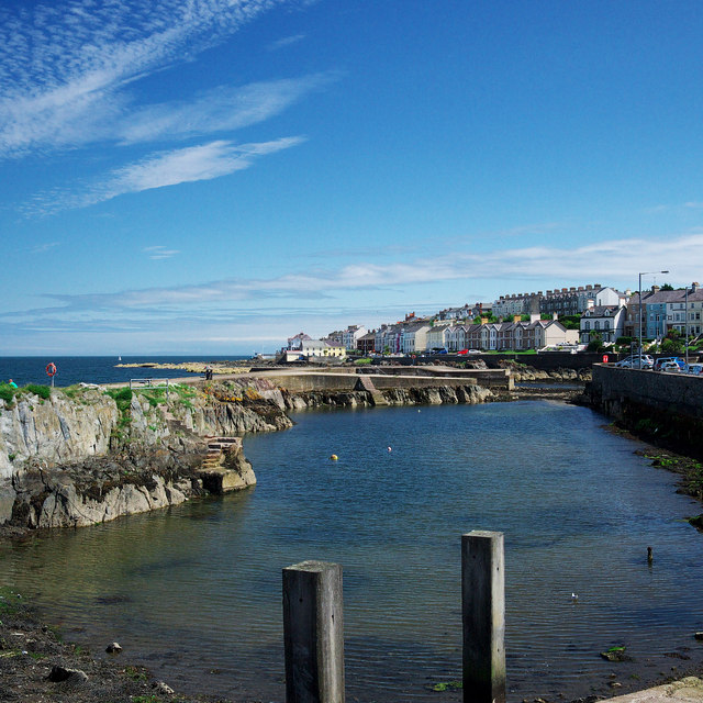
The 'Long Hole' in Bangor on a bright, warm and sunny July morning - something of a rarity in the summer of 2012.
The Long Hole
Also known as the 'Big Hole', this small harbour in Bangor, now silted up and disused, was created when stone was quarried out in the 19th Century.
![Creative Commons Licence [Some Rights Reserved]](https://s1.geograph.org.uk/img/somerights20.gif)
|
· Find out How to reuse this image ·
Share:
|
|||||
| Start a discussion on J5082 | Suggest an update to this image | Contact the contributor | |||
Loading map... (JavaScript required)
- Grid Square
- J5082, 2267 images (more nearby
 )
)
- Photographer
- Rossographer (find more nearby)
- Date Taken
- Thursday, 26 July, 2012 (more nearby)
- Submitted
- Monday, 30 July, 2012
- Geographical Context
- Place (from Tags)
- Former (from Tags)
- Subject Location
-
Irish:
 J 506 823 [100m precision]
WGS84: 54:39.9768N 5:39.9407W - Camera Location
-
Irish: J 505 822
- View Direction
- East-northeast (about 67 degrees)
Other Tags
Image classification(about):
Geograph
This page has been viewed about 157 times.
View this location:
KML (Google Earth) ·
Google Maps ·
Bing Maps ·
Geograph Coverage Map ·
More Links for this image
·
Bing Maps ·
Geograph Coverage Map ·
More Links for this image