G7127 : Sligo Leitrim & Northern Counties Railway
taken 12 years ago, near to Ballygawley, Co Sligo, Ireland
Sligo Leitrim & Northern Counties Railway
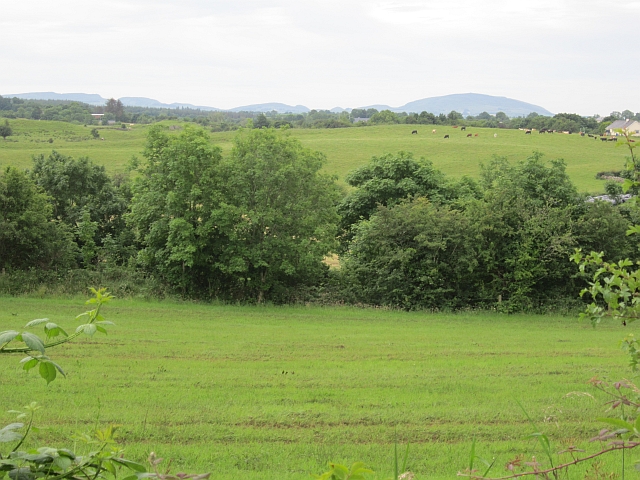
The double hedge amongst the grassland is the trackbed of the Sligo Leitrim & Northern Counties Railway which until 1957 connected Enniskillen and Sligo.
![Creative Commons Licence [Some Rights Reserved]](https://s1.geograph.org.uk/img/somerights20.gif)
|
· Find out How to reuse this image ·
Share:
|
|||||
| Start a discussion on G7127 | Suggest an update to this image | Contact the contributor | |||
Loading map... (JavaScript required)
- Grid Square
- G7127, 3 images (more nearby
 )
)
- Photographer
- Richard Webb (find more nearby)
- Date Taken
- Saturday, 21 July, 2012 (more nearby)
- Submitted
- Wednesday, 1 August, 2012
- Geographical Context
- Railway (from Tags)
- Subject Location
-
Irish:
 G 715 271 [100m precision]
WGS84: 54:11.5750N 8:26.1683W - Camera Location
-
Irish: G 716 272
- View Direction
- South-southwest (about 202 degrees)
Image classification(about):
Geograph (Second Visitor for G7127)
This page has been viewed about 93 times.
View this location:
KML (Google Earth) ·
Google Maps ·
Bing Maps ·
Geograph Coverage Map ·
More Links for this image
·
Bing Maps ·
Geograph Coverage Map ·
More Links for this image