B8833 : View of the pier for the ferry to Tory Island
taken 18 years ago, near to Meenlaragh, Co Donegal, Ireland
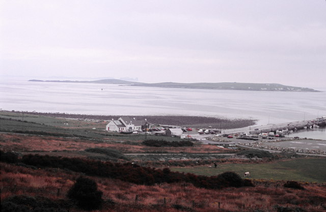
View of the pier for the ferry to Tory Island
All of the buildings and the pier itself lie within the square. Also all of the land to its right is in the square.
The island of Inishbofin can be seen in the distance.
The island of Inishbofin can be seen in the distance.
![Creative Commons Licence [Some Rights Reserved]](https://s1.geograph.org.uk/img/somerights20.gif)
|
· Find out How to reuse this image ·
Share:
|
|||||
| Start a discussion on B8833 | Suggest an update to this image | Contact the contributor | |||
Loading map... (JavaScript required)
- Grid Square
- B8833, 27 images (more nearby
 )
)
- Photographer
- Kieran Evans (find more nearby)
- Date Taken
- Wednesday, 26 July, 2006 (more nearby)
- Submitted
- Saturday, 6 January, 2007
- Category
- Piers > Piers (more nearby)
- Subject Location
-
Irish:
 B 88 33 [1000m precision]
WGS84: 55:8.9132N 8:10.8671W - View Direction
- NORTH (about 0 degrees)
This page has been viewed about 167 times.
View this location:
KML (Google Earth) ·
Google Maps ·
Bing Maps ·
Geograph Coverage Map ·
More Links for this image
·
Bing Maps ·
Geograph Coverage Map ·
More Links for this image