J2664 : "The Tavern", Lisburn (2012-2)
taken 12 years ago, near to Lisburn, Co Antrim, Northern Ireland
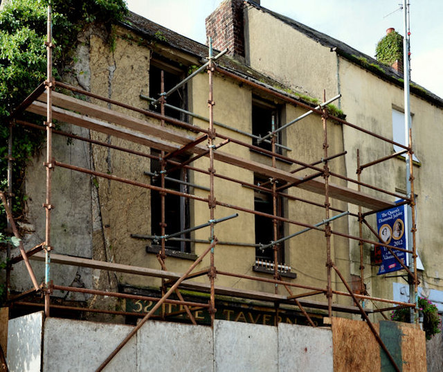
"The Tavern", Lisburn (2012-2)
See J2664 : "The Tavern", Lisburn (2012-1). The front of the building being supported by scaffolding. Continue to J2664 : "The Tavern", Lisburn (2012-3).
Bridge Street, Lisburn
Bridge Street runs from Market Square to the Queens Road and the Union Bridge. The northern side is occupied shops. The southern side is occupied shops, vacant buildings and vacant ground.
![Creative Commons Licence [Some Rights Reserved]](https://s1.geograph.org.uk/img/somerights20.gif)
|
· Find out How to reuse this image ·
Share:
|
|||||
| Start a discussion on J2664 | Suggest an update to this image | Contact the contributor | |||
Loading map... (JavaScript required)
- Grid Square
- J2664, 512 images (more nearby
 )
)
- Photographer
- Albert Bridge (find more nearby)
- Date Taken
- Sunday, 23 September, 2012 (more nearby)
- Submitted
- Sunday, 23 September, 2012
- Geographical Context
- Subject Location
-
Irish:
 J 268 642 [100m precision]
WGS84: 54:30.6353N 6:2.4977W - Camera Location
-
Irish: J 269 642
- View Direction
- Southwest (about 225 degrees)
Other Tags
Image classification(about):
Supplemental image
This page has been viewed about 80 times.
View this location:
KML (Google Earth) ·
Google Maps ·
Bing Maps ·
Geograph Coverage Map ·
More Links for this image
·
Bing Maps ·
Geograph Coverage Map ·
More Links for this image