S7220 : West summit of Slievecoiltia
taken 12 years ago, 5 km N of Campile, Co Wexford, Ireland
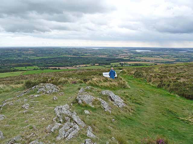
West summit of Slievecoiltia
One of various isolated hills which rise from the plains of County Wexford. Slievecoiltia lies within the estate of the JF Kennedy Memorial Arboretum, which can be seen at the foot of the hill. The west summit reaches an altitude of 268 metres. In the distance can be seen Waterford Harbour, an estuary formed at the confluence of the Rivers Suir and Barrow.
![Creative Commons Licence [Some Rights Reserved]](https://s1.geograph.org.uk/img/somerights20.gif)
|
· Find out How to reuse this image ·
Share:
|
|||||
| Start a discussion on S7220 | Suggest an update to this image | Contact the contributor | |||
Loading map... (JavaScript required)
- Grid Square
- S7220, 4 images (more nearby
 )
)
- Photographer
- Oliver Dixon (find more nearby)
- Date Taken
- Wednesday, 19 September, 2012 (more nearby)
- Submitted
- Friday, 28 September, 2012
- Geographical Context
- Subject Location
-
Irish:
 S 725 209 [100m precision]
WGS84: 52:20.1442N 6:56.2011W - Camera Location
-
Irish: S 726 209
- View Direction
- West-southwest (about 247 degrees)
Other Tags
Image classification(about):
Geograph
This page has been viewed about 47 times.
View this location:
KML (Google Earth) ·
Google Maps ·
Bing Maps ·
Geograph Coverage Map ·
More Links for this image
·
Bing Maps ·
Geograph Coverage Map ·
More Links for this image