S8808 : Ballyteige Lagoon
taken 12 years ago, 3 km from Carrick, Co Wexford, Ireland
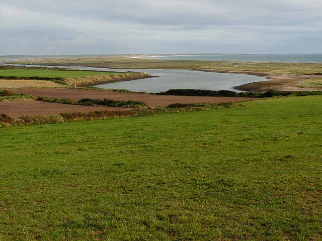
Ballyteige Lagoon
A view of the 7 km long lagoon trapped behind a long sandbar. The beach extends a total of 11 km round to Forlorn Point at Kilmore Quay S9603 seen in the far distance.
![Creative Commons Licence [Some Rights Reserved]](https://s1.geograph.org.uk/img/somerights20.gif)
|
· Find out How to reuse this image ·
Share:
|
|||||
| Start a discussion on S8808 | Suggest an update to this image | Contact the contributor | |||
Loading map... (JavaScript required)
- Grid Square
- S8808, 4 images (more nearby
 )
)
- Photographer
- Oliver Dixon (find more nearby)
- Date Taken
- Sunday, 16 September, 2012 (more nearby)
- Submitted
- Saturday, 29 September, 2012
- Geographical Context
- Subject Location
-
Irish:
 S 883 081 [100m precision]
WGS84: 52:13.0833N 6:42.4460W - Camera Location
-
Irish: S 881 083
- View Direction
- Southeast (about 135 degrees)
Other Tags
Image classification(about):
Geograph
This page has been viewed about 40 times.
View this location:
KML (Google Earth) ·
Google Maps ·
Bing Maps ·
Geograph Coverage Map ·
More Links for this image
·
Bing Maps ·
Geograph Coverage Map ·
More Links for this image