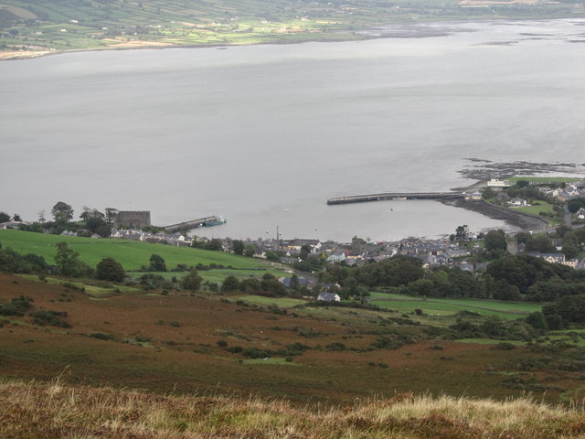
J1811 : Carlingford Harbour from Goylin Pass
taken 12 years ago, near to Carlingford, Co Louth, Ireland
![Creative Commons Licence [Some Rights Reserved]](https://s1.geograph.org.uk/img/somerights20.gif)
|
· Find out How to reuse this image ·
Share:
|
|||||
| Start a discussion on J1811 | Suggest an update to this image | Contact the contributor | |||
Loading map... (JavaScript required)
- Grid Square
- J1811, 302 images (more nearby
 )
)
- Photographer
- Eric Jones (find more nearby)
- Date Taken
- Saturday, 29 September, 2012 (more nearby)
- Submitted
- Wednesday, 3 October, 2012
- Geographical Context
- Subject Location
-
Irish:
 J 189 117 [100m precision]
WGS84: 54:2.4827N 6:11.0896W - Camera Location
-
Irish: J 177 107
- View Direction
- Northeast (about 45 degrees)
Image classification(about):
Supplemental image
This page has been viewed about 29 times.
View this location:
KML (Google Earth) ·
Google Maps ·
Bing Maps ·
Geograph Coverage Map ·
More Links for this image
·
Bing Maps ·
Geograph Coverage Map ·
More Links for this image