O2033 : The Poolbeg Power Stations (aerial) 2003
taken 21 years ago, near to Irishtown, Dublin, Ireland
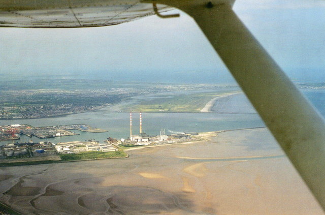
The Poolbeg Power Stations (aerial) 2003
A familiar landmark, and a welcome first sight of land, for pilots crossing from England and Wales.
View from the south with the mouth of the River Liffey beyond.
View from the south with the mouth of the River Liffey beyond.
![Creative Commons Licence [Some Rights Reserved]](https://s1.geograph.org.uk/img/somerights20.gif)
|
· Find out How to reuse this image ·
Share:
|
|||||
| Start a discussion on O2033 | Suggest an update to this image | Contact the contributor | |||
Loading map... (JavaScript required)
- Grid Square
- O2033, 41 images (more nearby
 )
)
- Photographer
- Chris (find more nearby)
- Date Taken
- Friday, 13 June, 2003 (more nearby)
- Submitted
- Saturday, 6 October, 2012
- Geographical Context
- Subject Location
-
Irish:
 O 207 337 [100m precision]
WGS84: 53:20.4160N 6:11.2905W - Camera Location
-
Irish: O 198 319
- View Direction
- North-northeast (about 22 degrees)
Image classification(about):
Supplemental image
This page has been viewed about 31 times.
View this location:
KML (Google Earth) ·
Google Maps ·
Bing Maps ·
Geograph Coverage Map ·
More Links for this image
·
Bing Maps ·
Geograph Coverage Map ·
More Links for this image