J3576 : Belfast West Power Station
taken 19 years ago, 3 km from Belfast, Co Antrim, Northern Ireland
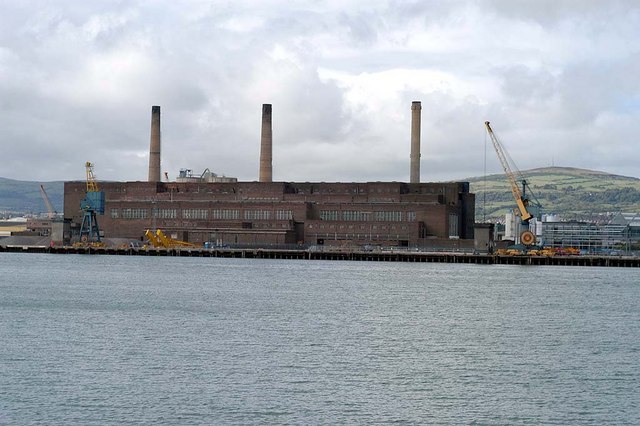
Belfast West Power Station
The closed Belfast West Power Station,Stormont Wharf, photographed from the Queens Island side of the Victoria Channel
![Creative Commons Licence [Some Rights Reserved]](https://s1.geograph.org.uk/img/somerights20.gif)
|
· Find out How to reuse this image ·
Share:
|
|||||
| Start a discussion on J3576 | Suggest an update to this image | Contact the contributor | |||
Loading map... (JavaScript required)
- Grid Square
- J3576, 974 images (more nearby
 )
)
- Photographer
- Wilson Adams (find more nearby)
- Date Taken
- Sunday, 25 September, 2005 (more nearby)
- Submitted
- Sunday, 4 February, 2007
- Category
- Power Station > Power station (more nearby)
- Subject Location
-
Irish:
 J 35 76 [1000m precision]
WGS84: 54:37.1107N 5:54.1884W
Image classification(about):
Supplemental image
This page has been viewed about 1404 times.
View this location:
KML (Google Earth) ·
Google Maps ·
Bing Maps ·
Geograph Coverage Map ·
More Links for this image
·
Bing Maps ·
Geograph Coverage Map ·
More Links for this image