2004
SH5838 : Afon Glaslyn near Porthmadog
taken 20 years ago, near to Portmeirion, Gwynedd, Wales
This is 1 of 7 images, with title starting with Afon Glaslyn in this square
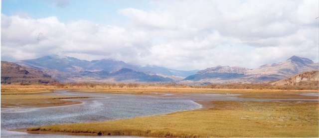
Afon Glaslyn near Porthmadog
When the slate port of Porthmadog was developed by William Madocks in the 19th century, a huge embankment was built across the mouth of the Afon Glaslyn, thus making it possible to reclaim much land for farming and also producing a large area of saltmarsh.
 Map © Crown Copyright")
TIP: Click the map for more Large scale mapping
- Grid Square
- SH5838, 94 images (more nearby 🔍)
- Photographer
- Gordon Hatton (more nearby)
- Date Taken
- April 2004 (more nearby)
- Submitted
- Friday, 9 February, 2007
- Subject Location
-
OSGB36:
 SH 584 382 [100m precision]
WGS84: 52:55.3823N 4:6.4368W - Camera Location
-
OSGB36: SH 582 379
- View Direction
- North-northeast (about 22 degrees)