G7377 : Thatching in Carricknagore
taken 11 years ago, near to Bruckless, Co Donegal, Ireland
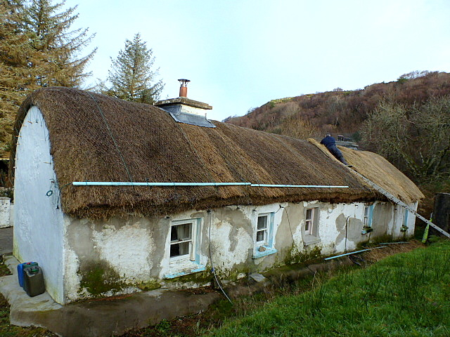
Thatching in Carricknagore
Using rye stalks grown in Raphoe to patch up the thatch.
![Creative Commons Licence [Some Rights Reserved]](https://s1.geograph.org.uk/img/somerights20.gif)
|
· Find out How to reuse this image ·
Share:
|
|||||
| Start a discussion on G7377 | Suggest an update to this image | Contact the contributor | |||
Loading map... (JavaScript required)
- Grid Square
- G7377, 3 images (more nearby
 )
)
- Photographer
- louise price (find more nearby)
- Date Taken
- Friday, 30 November, 2012 (more nearby)
- Submitted
- Monday, 1 April, 2013
- Geographical Context
- Subject Location
-
Irish:
 G 734 776 [100m precision]
WGS84: 54:38.7729N 8:24.7483W - Camera Location
-
Irish: G 734 775
- View Direction
- Northwest (about 315 degrees)
Image classification(about):
Geograph (Second Visitor for G7377)
This page has been viewed about 74 times.
View this location:
KML (Google Earth) ·
Google Maps ·
Bing Maps ·
Geograph Coverage Map ·
More Links for this image
·
Bing Maps ·
Geograph Coverage Map ·
More Links for this image