C4416 : Waterside station interior - June 1979 (2)
taken 45 years ago, near to Londonderry, Northern Ireland
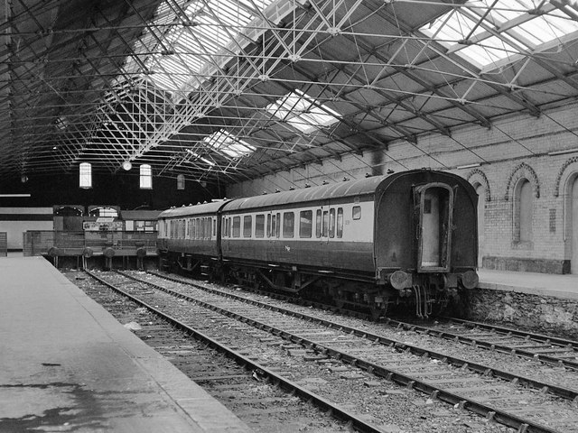
The Londonderry & Coleraine Railway (L&C) opened its line from Waterside to Limavady Junction in 1852, extending to Coleraine in 1853. From 1861, the L&C was leased to the Belfast & Northern Counties Railway (BNCR), who absorbed the L&C in 1872. No records are known of the original L&C station, but the BNCR commissioned an impressive dressed sandstone structure from John Lanyon, which opened in 1875. In addition to the usual train shed, waiting, booking and refreshment facilities, this building also contained living accommodation, in use up to 1975 when the last resident was Northern Ireland Railways then North West Area Manager, Mr Alec Esdale. Unfortunately, the station was bombed in 1972, when the refreshment rooms were destroyed, and again on 22 September 1975 which obliterated the entire centre section.
Northern Ireland Railways closed Lanyons station on 24 February 1980, moving to new premises which, while closer to the Craigavon Bridge linking Waterside with the City, is a building of limited architectural merit. However,press reports in March 2014 confirm the station is to be restored and returned to use as a railway terminus: Link
More information can be found: Link
For the purpose of this Shared Description, Waterside station comprises the area from the 1980 station to the former down distant signal.
![Creative Commons Licence [Some Rights Reserved]](https://s1.geograph.org.uk/img/somerights20.gif)
|
· Find out How to reuse this image ·
Share:
|
|||||
|
There is 1 post in a
discussion on C4416 (preview on the left) |
Suggest an update to this image | Contact the contributor | |||
- Grid Square
- C4416, 199 images (more nearby
 )
)
- Photographer
- The Carlisle Kid (find more nearby)
- Date Taken
- Saturday, 23 June, 1979 (more nearby)
- Submitted
- Thursday, 13 June, 2013
- Geographical Context
- Subject Location
-
Irish:
 C 440 168 [100m precision]
WGS84: 54:59.8044N 7:18.7958W - Camera Location
-
Irish: C 440 168
- View Direction
- SOUTH (about 180 degrees)