NT2772 : Salisbury Crags
taken 11 years ago, near to Edinburgh, Scotland
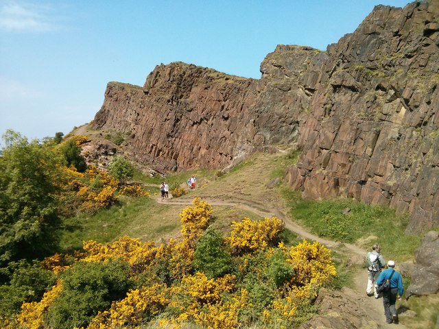
Generally popular with visitors on a Sunny Sunday.
An excursion around the 2013 Geograph conference and AGM in Edinburgh.
Although the Salisbury Crags form a familiar and prominent part of the view of Arthur's Seat, they are not, geologically speaking, related to the rest of Arthur's Seat at all!
They are the remnants of a sill of analcime-dolerite, formerly termed teschenite, which was intruded deep underground into the sandstones which underlie the Arthur's Seat volcano, long after the volcano had become extinct. Later again, earth movements tilted the whole structure so that the sill, like the lava flows that make up the volcano, now dips at 25º towards the east. The exposed scarp is up to 46 metres high, but it was quarried from about 200 years ago, and in places the present line of the scarp is well back from its original line.
The slope below is talus or scree, that is, loose pieces of rock which have fallen from the rock face and rolled downhill.
The crags, and especially the faces in the quarried parts, have been popular for climbing, but climbing is now controlled by the ranger service, and mostly takes place in the form of bouldering, resulting in trails of white chalk dust across the quarry faces.
The broad path round the foot of the crags is called the Radical Road. It is said to have been so named because it was paved by unemployed weavers after the 'Radical War' of 1820, a spell of strikes and unrest among artisans and skilled craftsmen seeking improved working conditions.
There is some doubt about the origin of the name Salisbury Crags. It has been suggested that they were named after the Earl of Salisbury, who accompanied King Edward III of England on an expedition to Scotland, but a more likely explanation is Lord Hailes' suggestion that is it from Anglo-Saxon and means a waste or dry settlement.
 Map © Crown Copyright")
- Grid Square
- NT2772, 489 images (more nearby 🔍)
- Photographer
- Barry Hunter (more nearby)
- Date Taken
- Sunday, 9 June, 2013 (more nearby)
- Submitted
- Wednesday, 19 June, 2013
- Subject Location
-
OSGB36:
 NT 271 729 [100m precision]
WGS84: 55:56.6157N 3:10.1055W - Camera Location
-
OSGB36: NT 271 728
- View Direction
- West-northwest (about 292 degrees)