O0631 : Camac River approaching Fonthill Road near Clondalkin
taken 11 years ago, near to Clondalkin, Dublin, Ireland
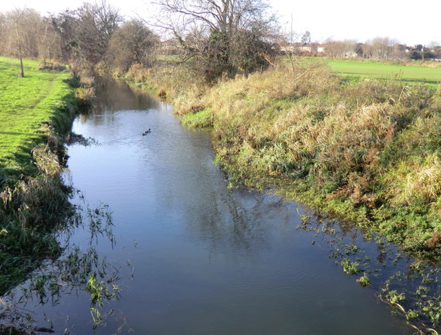
Camac River approaching Fonthill Road near Clondalkin
The Camac River (also known as the Cammoge, Cammock, etc.) is one of the Liffey's bigger tributaries, coming from the Slade of Saggart in the far south of County Dublin. Here it comes placidly towards the Fonthill Road, and heads on under the road to bend in the direction of Clondalkin.
![Creative Commons Licence [Some Rights Reserved]](https://s1.geograph.org.uk/img/somerights20.gif)
|
· Find out How to reuse this image ·
Share:
|
|||||
| Start a discussion on O0631 | Suggest an update to this image | Contact the contributor | |||
Loading map... (JavaScript required)
- Grid Square
- O0631, 10 images (more nearby
 )
)
- Photographer
- jwd (find more nearby)
- Date Taken
- Sunday, 23 December, 2012 (more nearby)
- Submitted
- Tuesday, 9 July, 2013
- Geographical Context
- Subject Location
-
Irish:
 O 063 310 [100m precision]
WGS84: 53:19.1301N 6:24.3201W - Camera Location
-
Irish: O 063 310
- View Direction
- West-southwest (about 247 degrees)
Image classification(about):
Geograph (Third Visitor for O0631)
This page has been viewed about 106 times.
View this location:
KML (Google Earth) ·
Google Maps ·
Bing Maps ·
Geograph Coverage Map ·
More Links for this image
·
Bing Maps ·
Geograph Coverage Map ·
More Links for this image